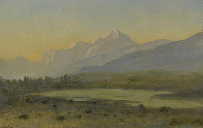
Owens Valley. Owens Valley is an arid valley of the Owens River in eastern California in the United States. It is located to the east of the Sierra Nevada, west of the White Mountains and Inyo Mountains, and is split between the Great Basin Desert and the Mojave Desert. The mountain peaks on the West side reach above 14,000 feet in elevation, while the floor of the Owens Valley is about 4,000 feet, making the valley the deepest in the United States. The Sierra Nevada casts the valley in a rain shadow, which makes Owens Valley the Land of Little Rain. The bed of Owens Lake, now a predominantly dry endorheic alkali flat, sits on the southern end of the valley. The current arid nature of the valley is mostly due to the Los Angeles Department of Water and Power diverting the water of the region. The valley provides water to the Los Angeles Aqueduct, the source of one-third of the water for city, and was the area at the center of one of the fiercest and longest-running episodes of the California Water Wars. Owens Lake was completely emptied by 1926, only 13 years after Los Angeles began diverting water. The water diversions inspired aspects of the 1974 film Chinatown. Towns in the Owens Valley include Bishop, Lone Pine, Independence and Big Pine; about 25,000 people live in the valley. The major road in the Owens Valley is U.S. Route 395. Owens Valley, photographed from Sawmill Pass by Ansel Adams, circa 1936. About three million years ago, the Sierra Nevada Fault and the White Mountains Fault systems became active with repeated episodes of slip earthquakes gradually producing the impressive relief of the eastern Sierra Nevada and White Mountain escarpments that bound the northern Owens Valley-Mono Basin region. Owens Valley is a graben, a down-dropped block of land between two vertical faults, the westernmost in the Basin and Range Province. It is also part of a trough which extends from Oregon to Death Valley called the Walker Lane. The western flank of much of the valley has large moraines coming off the Sierra Nevada. These unsorted piles of rock, boulders, and dust were pushed to where they are by glaciers during the last ice age. An excellent example of a moraine is on State Route 168 as it climbs into Buttermilk Country. This graben was formed by a long series of earthquakes, such as the 1872 Lone Pine earthquake, that have moved the graben down and helped move the Sierra Nevada up. The graben is much larger than the depth of the valley suggests; gravity studies suggest that 10,000 feet of sedimentary rock mostly fills the graben and that a very steep escarpment is buried under the western length of the valley. The topmost part of this escarpment is exposed at Alabama Hills. The Owens Valley has many mini-volcanoes, such as Crater Mountain in the Big Pine volcanic field. Smaller versions of the Devils Postpile, can be found, for example, by Little Lake. The valley is split between four different ecoregions, as defined by the United States Environmental Protection Agency: Upper Owens Valley and Tonopah Sagebrush Foothills, and Western Mojave Basins and Mojave Playas. The floor of the valley, roughly north of the town of Independence, California, lies in the Upper Owens Valley ecoregion. The ecoregion also includes the distinct Alabama Hills in the far south. The primary landforms of this ecoregion are gently to moderately sloping alluvial fans and mostly level basin floors, terraces, and floodplains. Elevations range from about 3,800 feet along the Owens River in the south to more than 6,000 feet where the higher fans descend from adjacent mountains. Alluvium from the Quaternary period covers the region, with some small areas of lava flows. Shrub-covered rangeland is the dominant land cover, with minor areas of hay and pastureland. Vegetation includes big sagebrush, rabbitbrush, spiny hopsage, antelope bitterbrush, saltbush, ephedra, and several perennial grasses including desert needlegrass. Along the Owens River, some restoration of cottonwoods, willows, and wetlands has occurred. The eastern slopes of the valley lie in the Tonopah Sagebrush Foothills ecoregion. The soil is rocky and lacks the fine sediments found at lower elevations of the Tonopah Basin. Great Basin species are common in this ecoregion. However, because the ecoregion is in the rain shadow of the Sierra Nevada, and is adjacent to the Mojave Desert, the aridity leads to black sagebrush being common and the more mesic understory species being largely absent. Other Mojave Desert species, such as blackbrush, Joshua tree, and cholla cactus are common where summer moisture is more prevalent. Streams are ephemeral and flow during and immediately after storms.