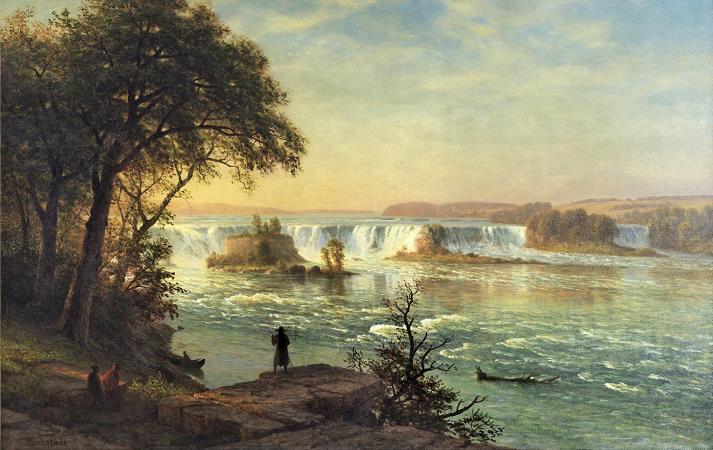
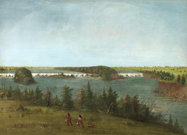
Saint Anthony Falls. Saint Anthony Falls, or the Falls of Saint Anthony, northeast of downtown Minneapolis, Minnesota, was the only natural major waterfall on the Upper Mississippi River. The natural falls were replaced by a concrete overflow spillway after it partially collapsed in 1869. Later, in the 1950s and 1960s, a series of locks and dams was constructed to extend navigation to points upstream. The falls are named after the Catholic saint Anthony of Padua. The towns of St. Anthony and Minneapolis, which had developed on the east and west sides of the falls, respectively, merged in 1872 to fully use the power of the falls for milling operations. From 1880 to about 1930, Minneapolis was the Flour Milling Capital of the World. Today, the falls are defined by the locks and dams of the Upper Saint Anthony Falls, just downstream of the 3rd Avenue Bridge, and the Lower Saint Anthony Falls, just upstream of the I-35W Saint Anthony Falls Bridge. These locks were built as part of the Upper Mississippi River 9-Foot Navigation Project. The area around the falls is designated the St. Anthony Falls Historic District and features a 1.8-mile self-guided walking trail with signs explaining the area's past. Before European exploration, the falls held cultural and spiritual significance for native tribes who frequented and lived in the area. The falls was an important and sacred site to the Mdewakanton Dakota and they called the Mississippi River, hahawakpa, river of the falls. The falls themselves were given specific names, mnirara curling waters, owahmenah falling waters, or owamni, whirlpool. Dakota associated the falls with legends and spirits, including Oanktehi, god of waters and evil, who lived beneath the falling water. The sacred falls also enters into their oral tradition by a story of a warrior's first wife who killed herself and their two children in anguish and forlorn love for the husband who had assumed a second wife. The rocky islet where the woman had pointed her canoe toward doom thus was named Spirit Island which was once a nesting ground for eagles that fed on fish below the falls. Dakota also camped on Nicollet Island upstream of the falls to fish and to tap the sugar maple trees. Since the cataract had to be portaged, the area became one of the natural resting and trade points along the Mississippi between Dakota and Anishinaabe peoples. The Anishinaabe term was recorded as kakabikah. In 1680, the falls became known to the Western world when they were observed and published in a journal by Father Louis Hennepin, a Catholic friar of Belgian birth, who also first published about Niagara Falls to the world's attention. Hennepin named them the Chutes de Saint-Antoine or the Falls of Saint Anthony after his patron saint, Anthony of Padua. Later explorers to document the falls include Zebulon Montgomery Pike and Jonathan Carver, the first Englishman to undertake an exploration of the west. According to the John Carter Brown Library, Carver's purpose was to map the land, to befriend the native Americans, and to discover the Northwest passage. His journey began in 1766 and, in some ways, was the precursor of the Lewis and Clark expedition; his book was the first popular American travel book. Carver created this early image, an engraving of the falls, in 1778. Following the establishment of Fort Snelling in 1820, the falls became an attraction for tourists, writers and artists who sought inspiration even if Hennepin's descriptions were not as majestic as hoped for. By the 1860s, however, industrial waste had filled the area and marred the falls' majesty. Further competition over the power of the falls on both banks of the river led to its eventual downfall when it partially collapsed in 1869 and was reinforced and subsequently sealed by a concrete overflow spillway. The area around the river was added to the National Register of Historic Places as the Saint Anthony Falls Historic District in 1971 which includes 8th Avenue Northeast extending downstream to 6th Avenue Southeast and approximately two city blocks on both shoreline. The district's archaeological record is one of the most-endangered historic sites in Minnesota. The National Register of Historic Places is facilitated by the National Park Service. The national significance of the Saint Anthony Falls Historic District is a major reason why the National Park Service's Mississippi National River and Recreation Area was established along the Mississippi River in the Minneapolis-Saint Paul metropolitan area. A Heritage Trail plaque nearby says, For untold generations of Indian people the Mississippi River was an important canoe route. To pass around the falls, the Dakota and Ojibway used a well-established portage trail.
more...


