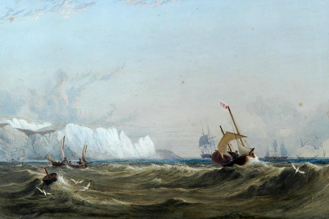
White Cliffs of Dover. The White Cliffs of Dover, part of the North Downs formation, is the name given to the region of English coastline facing the Strait of Dover and France. The cliff face, which reaches a height of 350 feet, owes its striking appearance to its composition of chalk accented by streaks of black flint. The cliffs, on both sides of the town of Dover in Kent, stretch for eight miles. A section of coastline encompassing the cliffs was purchased by the National Trust in 2016. The cliffs are part of the Dover to Kingsdown Cliffs Site of Special Scientific Interest and Special Area of Conservation. The cliffs are part of the coastline of Kent in England between approximately and, at the point where Great Britain is closest to continental Europe. On a clear day they are visible from the French coast. The chalk cliffs of the Alabaster Coast of Normandy in France are part of the same geological system. The White Cliffs are at one end of the Kent Downs designated Area of Outstanding Natural Beauty. In 1999 a sustainable National Trust visitor centre was built in the area. The Gateway building, designed by van Heyningen and Haward Architects, houses a restaurant, an information centre on the work of the National Trust, and details of local archaeology, history and landscape. About 70 million years ago Great Britain and much of Europe were submerged under a great sea. The sea bottom was covered with white mud formed from fragments of coccoliths, the skeletons of tiny algae that floated in the surface waters and sank to the bottom during the Cretaceous period and, together with the remains of bottom-living creatures, formed muddy sediments. It is thought that the sediments were deposited very slowly, probably half a millimetre a year, equivalent to about 180 coccoliths piled one on top of another. Up to 500 metres of sediments were deposited in some areas. The weight of overlying sediments caused the deposits to become consolidated into chalk. Subsequent earth movements related to the formation of the Alps raised the sea-floor deposits above sea level. Until the end of the last glacial period, the British Isles were part of continental Europe, linked by the unbroken Weald-Artois Anticline, a ridge that acted as a natural dam to hold back a large freshwater pro-glacial lake, now submerged under the North Sea. The land masses remained connected until between 450,000 and 180,000 years ago when at least two catastrophic glacial lake outburst floods breached the anticline and destroyed the ridge that connected Britain to Europe. A land connection across the southern North Sea existed intermittently at later times when periods of glaciation resulted in lower sea levels. At the end of the last glacial period, around 10,000 years ago, rising sea levels finally severed the last land connection. The cliffs' chalk face shows horizontal bands of dark-coloured flint which is composed of the remains of sea sponges and siliceous planktonic micro-organisms that hardened into the microscopic quartz crystals. Quartz silica filled cavities left by dead marine creatures which are found as flint fossils, especially the internal moulds of Micraster echinoids. Several different ocean floor species such as brachiopods, bivalves, crinoids, and sponges can be found in the chalk deposits, as can sharks' teeth. In some areas, layers of a soft, grey chalk known as a hardground complex can be seen. Hardgrounds are thought to reflect disruptions in the steady accumulation of sediment when sedimentation ceased and/or the loose surface sediments were stripped away by currents or slumping, exposing the older hardened chalk sediment. A single hardground may have been exhumed 16 or more times before the sediments were compacted and hardened to form chalk. The White Cliffs of Dover have been eroding slowly but in the past 150 years they have been eroding ten times faster than they did before. This is because of the thinning of beaches that separate the cliffs from the sea and the fact that the cliffs themselves are made up of coccolithophore shells, which are chalk-based and unusual in forming calcium carbonate shells which eventually sink to the seabed to form chalky deposits that are vulnerable to erosion. The change is likely due to construction of sea walls and groynes, and stronger storms hitting the coastline due to climate change and the rise of in the ocean. Scientists say that the English Channel has eaten away at the cliffs at a rate of 8.7 inches to just over a foot. A thousand years ago, that rate was three-quarters of an inch to 2.3 inches per year. Over the years, the cliffs began to crumble as well and there have been sudden cliff falls due to the erosion of the chalk.
more...


