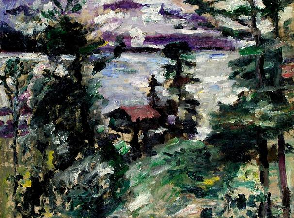
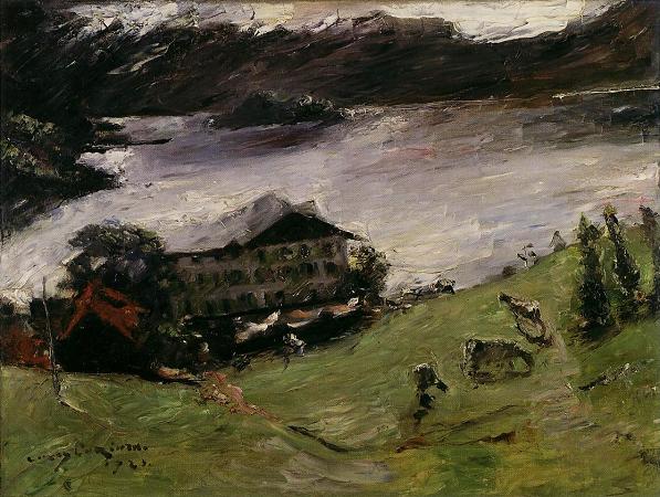
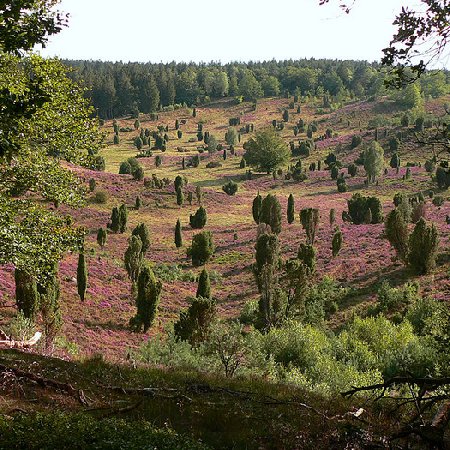
Walchensee. Walchensee or Lake Walchen is one of the deepest and largest alpine lakes in Germany, with a maximum depth of 192.3 metres and an area of 16.4 square kilometres. The lake is 75 kilometres south of Munich in the middle of the Bavarian Alps. The entire lake, including the island of Sassau, is within the municipality of Kochel. To the east and the south, the lake borders the municipality of Jachenau. The name Walchen comes from Middle High German and means strangers. All Roman and romanized peoples of the Alps south of Bavaria were known to the locals as Welsche or even Walche. This is also true of the etymology of the Swiss Lake Walen and the Salzburg Wallersee. Another possible interpretation is that it comes from the Latin Lacus vallensis, meaning lake in a valley. On 16th-century maps, the lake is also labelled dicto Italico, meaning leading to Italy, probably because the route through the Walchensee valley led through Mittenwald and Innsbruck to Italy. Walchensee fills a tectonic valley, part of the Bayerisches Synklinorium and from rocks of the triassic period. The extreme depth of the lake, 192.3 metres, is the result of this tectonic formation. The rock faces of the northwestern shore clearly show the steep arrangement of the rock layers. The creation of the lake from the forces of mountain building indicate that Walchensee could be one of the oldest lakes in Germany. During the ice age, the Isar-Loisach glacier repeatedly left its mark on the morphology of the area and thereby the Walchensee. The lake has a shoreline of approximately 27 kilometres and contains 1.3 cubic kilometres of water. The Jachen is the natural outflow of the lake, eastwards through the valley of Jachenau to the Isar. Obernach is the largest natural inflow to the lake, entering from the southwest. Together with the artificial inflow, the lake has a catchment basin of 780 square kilometres. Walchensee lies at 802 metres above sea level. It is surrounded by wooded mountains. To the northwest stands the Herzogstand-Heimgarten group at 1,731 metres and 1,790 metres respectively and to the west is the valley of the Eschenlaine. The south side of the Eschenlaine valley is the Simetsberg, which is the end of the Ester Mountains. To the south of the lake, the Altlacher Hochkopf separates Walchensee from the valley of the Isar. On the eastern shore lies the Jachenau, a long alpine valley that stretches in the direction of Lenggries. The northeast is dominated by the Benediktenwand. A little further to the west is Jochberg, which completes the valley wall. Between Herzogstand and Jochberg is little Kesselberg, which because of its relatively low prominence appears as a depression between the two higher peaks, but actually separates Walchensee from Kochelsee, 200 metres below. Directly on the west bank of the lake is the tiny Luftkurort settlement of Walchensee, with only about 600 inhabitants. Walchensee belongs to the municipality of Kochel as do the yet smaller settlements of Urfeld at the northern tip of the lake, Zwergen on the western shore, and the houses of Einsiedl am Walchensee on the orographic left bank of the Obernach at the far southwestern end of the lake. The houses of Einsiedl am Walchensee on the right bank of the Obernach and Altlach on the southern shore, the farmsteads of Matheis, Christopher, and Breitort, Sachenbach on the east shore, and Niedernach in the far southwest, belong to the municipality of Jachenau. Between the settlements of Walchensee and Einsiedl, the 1.4-square-kilometre Katzenkopf peninsula reaches 2 kilometres into the lake. The settlement of Zwergen lies on this peninsula. The surface of the lake forms a north-facing triangle, with the southern shore forming a 6.9-kilometre base from Einsiedl to Niedernach and the height reaching 5 kilometres from Breitort to Urfeld. Due to its location in a valley, the lake is protected from northern and eastern winds. The relatively low mountains on the south shore let in the optimal amount of sunlight, giving Walchensee a milder climate than one might expect in the mountains. During the summer months, heat on southern side of Herzogstand and Jochberg create strong thermals on sunny days. Stable thermal winds blow generally southwest. When the thermals carry saturated air masses from the Walchensee high into the air and mix with air from the more northerly Kochelsee by a prevailing wind from the northwest, it can lead to particularly violent thunderstorms. In contrast to a foehn, when a katabatic wind blows from south to north, the associated dry air ensures excellent visibility.