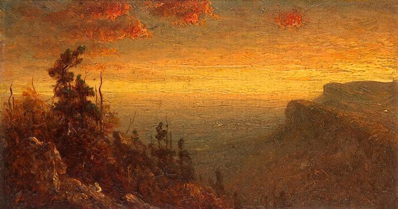
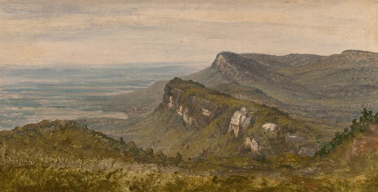
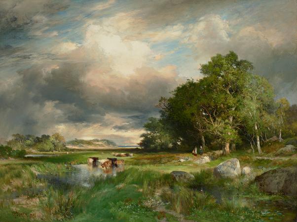
Shawangunk Ridge. The Shawangunk Ridge, also known as the Shawangunk Mountains or The Gunks, is a ridge of bedrock in Ulster County, Sullivan County and Orange County in the state of New York, extending from the northernmost point of New Jersey to the Catskill Mountains. Shawangunk Ridge is the continuation of the long, easternmost ridge of the Appalachian Mountains; the ridge is known as Kittatinny Mountain in New Jersey, and as Blue Mountain as it continues through Pennsylvania. This ridge constitutes the western border of the Great Appalachian Valley. The ridgetop, which widens considerably at its northern end, has many public and private protected areas and is not heavily populated. Its only settlement of consequence is unincorporated Cragsmoor. In the past, the ridge was chiefly noted for mining and logging and a boom-era of huckleberry picking. Fires were regularly set to burn away the undergrowth and stimulate new growth of huckleberry bushes. Today the ridge has become known for its outdoor recreation, most notably as one of the major rock climbing areas of North America, with many guides offering rock climbing trips in the area. Also known for its biodiversity and scenic character, the ridge has been designated by The Nature Conservancy as a significant area for its conservation programs. The English name, Shawangunk, derives from the Dutch Scha-wan-gunk, the closest European transcription from the colonial deed record of the Munsee Lenape, Schawankunk. Lenape linguist Raymond Whritenour reports that schawan is an inanimate intransitive verb meaning it is smoky air or there is smoky air. Its noun-like participle is schawank, meaning that which is smoky air. Adding the locative suffix gives us schawangunk in the smoky air. Whritenour has suggested that the name derives from the burning of a Munsee fort by the Dutch at the eastern base of the ridge in 1663. Use of the name spread quickly, and it was recorded in numerous land deeds and patents after the war. Historian Marc B. Fried writes: It is conceivable that this was.the Indians' own proper name for their village and that the name was appropriated for use in subsequent land dealings because of the proximity of the.tracts to the former Indian village.The second possibility is that the name simply came into existence in connection with the Bruyn, as a phrase invented by the Indians to describe some feature of the landscape. Fried also notes that the name's swift spread in the deed record suggests it was in use as a proper name before the Bruyn purchase. Shawangunk appears nowhere in reference to the fort in the extensive, translated Dutch record of the Second Esopus War. Shawangunk became associated with the ridge during the 18th century. In the original Lenape, the word is tri-syllabic, Sha-wan-gun, although in an occasional 18th-century deed it is written with a fourth syllable. The correct pronunciation approximates sha-wan-goon. The trailing k is sub vocal and modifies the sound of the n. European colonists began to truncate Shawangunk into Shongum. Shongum was mistakenly identified as the Munsee pronunciation by the Reverend Charles Scott writing on Shawangunk's etymology for the Ulster County Historical Society in 1861. The error has been reinforced in ethnographic sources and ridge literature, and by historians, librarians, and ridge educators for more than 140 years. Both Shawangunk and Shongum are popular usages among locals native to the region. The Gunks is also a widely used familiar term for the ridge and has been in use at least since the mid-19th century. In a letter dated August and postmarked August 8, 1838, Hudson River School painter Thomas Cole corresponding with painter A.B. Durand writes, Do let me hear from you when you get among the Gunks. I hope you will find every thing there your heart can wish. The Shawangunks, particularly around Lake Mohonk, were the subject for several Hudson River School painters. The Shawangunk Ridge is the northern end of a long ridge within the Appalachian Mountains that begins in Virginia, where it is called North Mountain, continues through Pennsylvania as Blue Mountain, becomes known as the Kittatinny Mountains after it crosses the Delaware Water Gap into New Jersey and becomes the Shawangunks at the New York state line. These mountains mark the western and northern edge of the Great Appalachian Valley. The ridge is widest near the northern end and narrow in the middle, with a maximum elevation of 2,289 feet near Lake Maratanza. The ridge rises above a broad, high plain which stretches to the Hudson River to the east.